(log in to access this feature)

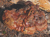
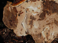
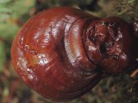
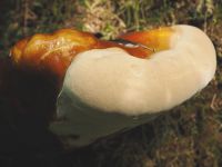
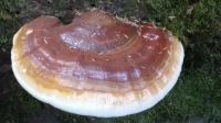
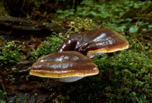
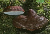
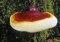
Photo © 2023 Carmel Cameron. Please contact the photographer to request permission to use this photo. If the photographer cannot be reached, inquire with the Collections Manager.
Photo metadata:
Original identification: Ganoderma oregonense
Current identification: Ganoderma oregonense
Photographer: Carmel Cameron
Date Photographed: August 29, 2023
Location: U.S.A., Washington, Mason County: Shady Lane Trail.
Elevation: 800 ft.
Coordinates: 47.5071772° N, 123.326693041° W
Uncertainty: 15 m.
Datum: WGS 84
Coordinate Source: GPS
Phenology: Fruits
Comments: 2 inch across.