(log in to access this feature)

Photo © 2021 Gerald D. Carr. Usage restrictions: Photos may be used without prior permission for strictly personal use or classroom instruction. Prior permission is required for any profit-seeking or commercial use, including books, printed material, computer programs, web sites, or any use in which the photos will be publicly accessible. (Contact the photographer.)
Photo metadata:
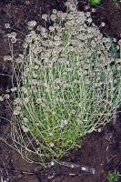
Original identification: Euchiton sphaericus
Current identification: Euchiton sphaericus
Photographer: Gerald D. Carr
Date Photographed: 2021
Location: U.S.A., Oregon, Benton County: Clear-cut on W side of Hwy 34, 3.1 mi. SW of jct. with Marys Peak Rd.
Elevation: 600 ft.
Coordinates: 44.4403°, -123.52941°
Datum: WGS84
Coordinate Source: GPS
latdegrees: 44.4403
latminutes:
latseconds:
longdegrees: 123.52941
longminutes:
longseconds:


